

Outlook on rising waters as snow melts in Uintas
This item is available in full to subscribers.
To continue reading, you will need to either log in to your subscriber account, or purchase a new subscription.
If you are a current print subscriber, you can set up a free website account and connect your subscription to it by clicking here.
If you are a digital subscriber with an active, online-only subscription then you already have an account here. Just reset your password if you've not yet logged in to your account on this new site.
Otherwise, click here to view your options for subscribing.
Please log in to continue |
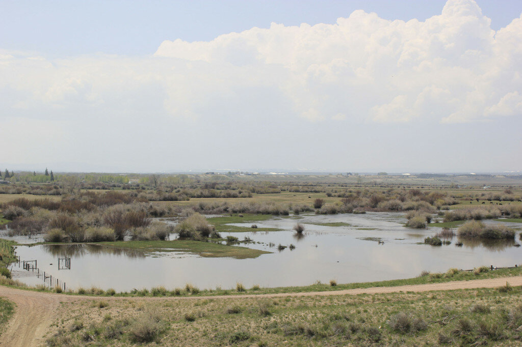
BRIDGER VALLEY — These pictures were taken over the weekend from the reservoir hill north of Fort Bridger. The Blacks Fork River has overflowed the banks south of Fort Bridger. The river is full and looks to be lapping near houses on HWY 412 on the road from the Urie 4-way to I-80.
Other waterways look close to overflowing, but are holding their own at the present even though the Bear River on the Evanston area is in a flood warning and on to the Randolph, Utah, area where it has already overflowed.
the BV Conservancy District on Thursday reported an increase of flow and irrigation storage over that which was reported on Tuesday for both Meeks Cabin and Stateline. Tuesday’s report was a slight decrease from the day before, but by Thursday, there was again an increase in the water.
As for Meeks, the BV Conservancy District report on Thursday was the inflow was at 1300 cubic feet per second (cfs), which was up about 140 cfs from the day before. Irrigation storage was 96 percent Thursday, up from 93 percent on Tuesday, and 1000 cfs were being release through the outer-works.
Stateline is at 94 percent irrigation storage Thursday, up from 72 percent on Tuesday. The inflow Thursday was at 390 cfs, which was up 65 cfs from the day before. There was 175 cfs being release through the outer-works, according to Thursday’s Conservancy report.


